Buenos Aires Ezeiza International Airport (EZE)
Orientation and Maps
(Buenos Aires, Argentina)
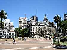
Argentina's capital city, Buenos Aires is located next to the Rio de la Plata river and is perhaps best known for its nightlife, fiestas and tango dancing. Buenos Aires is a particularly sophisticated Latin American city and also features a strong European feel. A wealthy city welcoming tourists, Buenos Aires hosts many seasonal festivals each year, including its popular 'Tango Day' each December.
Located in the outlying suburbs on the south-western side of Buenos Aires, the Ezeiza International Airport (EZE) is the biggest airport in the country. Also known as the Ministro Pistarini International Airport, this vast complex lies within the Ezeiza area, while the smaller Aeroparque Metropolitano Jorge Newbery domestic airport is located within the city itself.
Ezeiza International Airport (EZE) Maps: Important City Districts
Major districts within Buenos Aires include La Boca, which features a wealth of historical interest and many colourful buildings. La Boca is also home to plenty of places to eat out and be entertained, together with the popular Museo de Cera and Caminito craft fairs, which take place each weekend.
The Puerto Madero area of Buenos Aires has recently undergone considerable renovated and has become an appealing and attractive district. With numerous restaurants, clubs and bars, the city's Puerto Madero districts enjoys an enviable riverfront location. Other important neighbourhoods within the city of Buenos Aires include Monserrat, with many historic highlights such as the Plaza de Mayo and also the Iglesia de San Ignacio church; and the San Telmo area, where colonial-style buildings abound.
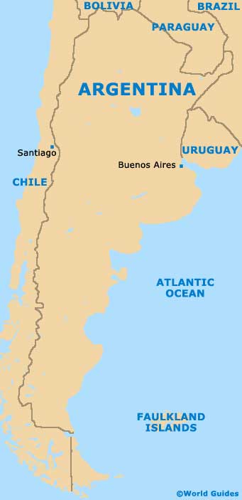
Argentina Map
Buenos Aires Map

